How the South Carolina State Ports Authority saves time and costs with a single source of truth
Precise property intelligence is helping the South Carolina State Ports Authority save tens of thousands of dollars a year in labor costs.
The challenge
The high cost of inaccurate, hard-to-find data
The South Carolina State Ports Authority needed a single, precise source of imagery its GIS, operations, engineering, and security teams could all build on and trust. Without it, they operated with:
- No reliable locational record: Teams relied on old paper maps and manual counts to find a location in the container yard and deploy field crews.
- Slow, costly data requests: A single locational asset analysis could take a full week of dedicated staff time — an estimated $2,000 in labor per request.
Now, Nearmap is South Carolina State Ports Authority’s primary locational system of record, from day-to-day operations to long-term GIS infrastructure. It is the default starting point for locating, planning, and protecting its terminals, and a shared reference every team works from.
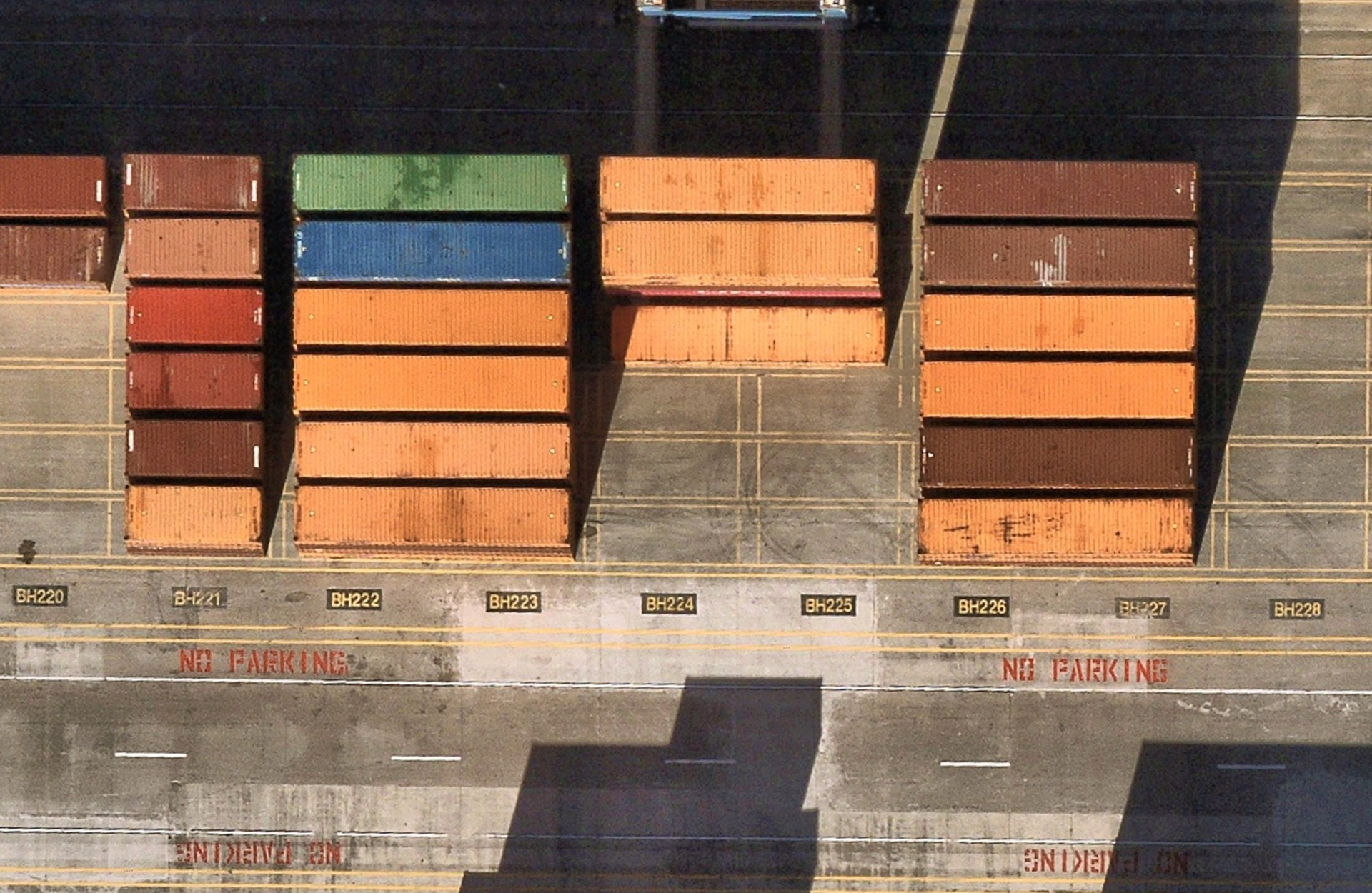
Precise Nearmap imagery shows terminal markings in detail
The solution
A reliable source of truth for more confident decision-making
South Carolina State Ports Authority provides its team with a precise and current base layer of Nearmap property intelligence that its team can confidently base critical infrastructure decisions upon:
- High-resolution vertical imagery (captured at up to 1.57-2.95 in / 4-7.5 cm or better ground sampling distance) is sharp enough to read terminal markings, map potential flood zones, and give crews a precise reference to work from in the field
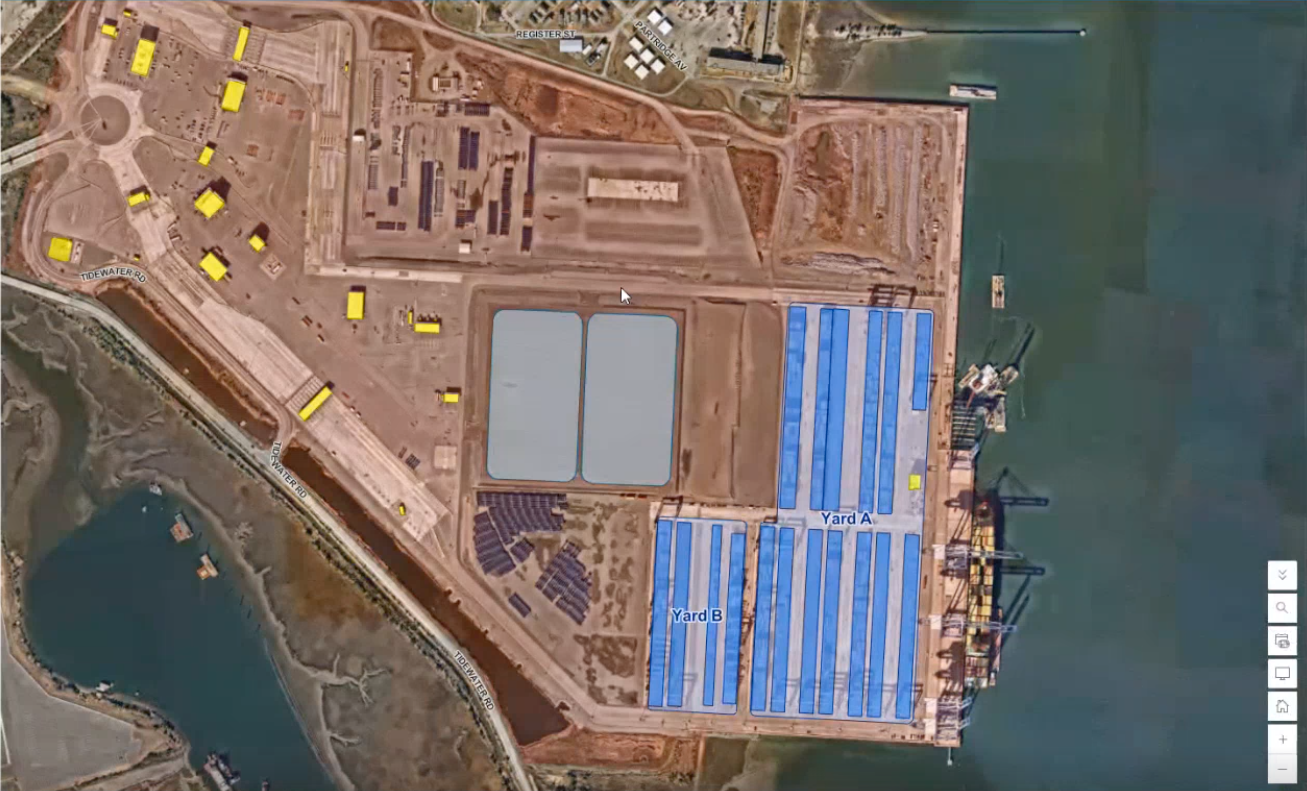
- Nearmap MapBrowser enables operations, engineering, and security teams to view, mark up, and share imagery and insights — flagging potential lease spaces, security features, and planned construction — within one application
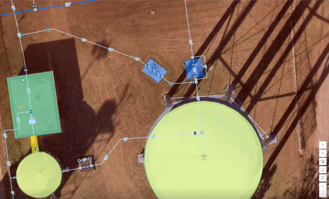
- Seamless integration with ArcGIS enables the team to accurately pin its own utility asset data directly on top of the most current and precise imagery — lining up water valves, fire hydrants, and building footprints — to enable more efficient asset management and maintenance
The impact
More precise insights surfaced faster
Time and cost savings
Locational asset lookups that once required a dedicated week of staff time now happen in minutes. Leveraging GIS data including that from Nearmap contributed to saving the equivalent of $34,000 in associated labor costs in 2025, and $42,000 so far in 2026.
More efficient field work
Now relying on a remotely accessible, collaborative, and precise source of truth instead of outdated paper maps, crews are sent to the right location the first time, every time.
Adoption at scale
Deploying a single source of property intelligence across security, engineering, and operations has ensured all teams work from the same operating picture.

About South Carolina State Ports Authority
South Carolina Ports owns and operates public seaport and intermodal facilities in Charleston, Greer and Dillon, handling more than $75 billion in commerce annually.
Home to the Southeast’s deepest port, SC Ports is the industry leader in delivering speed-to-market, seamless processes and flexibility to ensure reliable operations, big ship handling, efficient market reach and environmental responsibility.
Home to the Southeast’s deepest port, SC Ports is the industry leader in delivering speed-to-market, seamless processes and flexibility to ensure reliable operations, big ship handling, efficient market reach and environmental responsibility.
Get started today
Take advantage of full-stack property intelligence for better decision-making.